Remote sensing is one of the many tools in WithersRavenel’s Geomatics Practice Area toolbox. For people not involved with remote sensing on a daily basis, it can seem complicated. In this article I hope to demystify the subject by answering the following questions:
- What is remote sensing?
- Why do we use it?
- What types of remote sensing equipment do we use here at WithersRavenel?
What is remote sensing?
Google defines geomatics as the branch of science that deals with the collection, analysis, and interpretation of data relating to the earth’s surface.Every engineering design project at WithersRavenel is built upon a foundation of geomatics and accurate, quality data.
Remote sensing at WithersRavenel encompasses all our techniques for collecting geomatics data from a remote location. The distance we collect these measurements from can range from a few feet to a few hundred feet. We use drones, boats, lasers, and automobiles to collect this data remotely.
Why do we use remote sensing?
We use remote sensing techniques for a variety of reasons. Sometimes the surfaces being measured are hard to reach or making the measurements could put our technicians in an unsafe environment. Sometimes the project schedule doesn’t allow the time to collect the data manually. And sometimes the amount of data is so vast, or the level of detail required of the data is so high, that there is no other way to get the job done.
What are the different types of remote sensing equipment?
At WithersRavenel we deploy four different types of remote sensing equipment: UAS/Drones (Photogrammetry & LiDAR), Bathymetric Sonar, Static LiDAR (HD Scanning), and Mobile LiDAR. Some of this remote sensing terminology can be best understood relative to distance. Photogrammetry is photography specifically designed for surveying and measuring distance, sonar uses soundwaves to measure distance, and LiDAR (Light Detection and Ranging) uses lasers to measure distance.

UAS/Drones
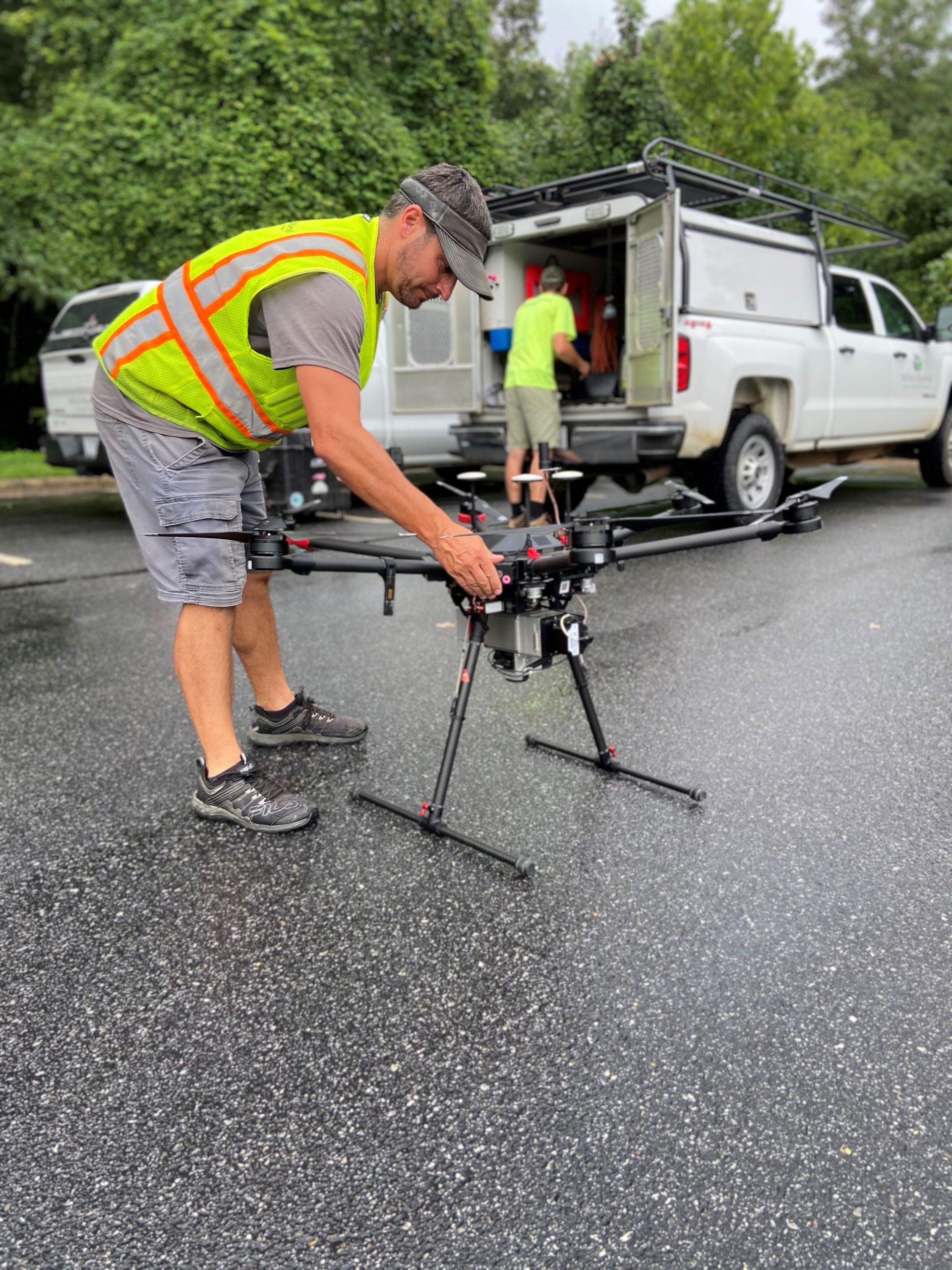
Unmanned Aerial Systems (UAS), more commonly referred to as drones, allow us to collect data on the surface of the earth from the air. At WithersRavenel we have a range of drone platforms, from small folding drones that can fit inside a backpack to a large hexa-copter (six rotors) that has a maximum carrying capacity of over 13 pounds.
Our drones can carry photogrammetry, thermal, and LiDAR sensors. Photogrammetry records data on the RGB – red, blue, and green – color spectrum. Thermal sensors collect data on the infrared (thermal or having to do with temperature) spectrum. LiDAR measures distance through high-speed lasers, and much more.
This data can be used to create large scale – and very accurate – orthorectified photos of land features and sites, topography maps, and to conduct planimetric surveys. Orthorectification is the process of removing camera end geographic distortions that make the photographs suitable for surveying and measuring. A planimetric survey is a survey related to a plane or surface. In our case, the plane is most often the ground surface.

Bathymetric
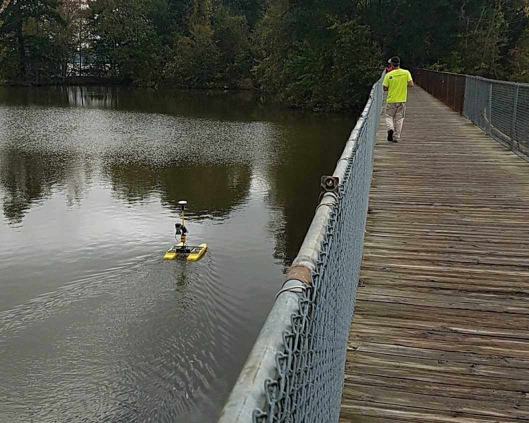
Bathymetric surveying is the practice of collecting data from a boat. WithersRavenel has a small electric double-pontoon boat that is 3 feet x 2 feet and is controlled remotely from shore. The boat is equipped with a single vertical sonar sensor that uses soundwaves to measure depth of a body of water.
These depth measurements, when combined with information about where on the body of water the measurements were collected, can be used to model the surface of the bottom of the body of water or measure the volume of the body of water.
Static LiDAR and Mobile LiDAR
Static LiDAR uses a sensor like the LiDAR sensors used on drones, but this sensor is mounted to a stationary tripod. The static LiDAR sensor can collect data from a 360-degree rotation around the tripod at a very high level of accuracy. These scans can be used to create surface models of the interior of structures or can be used to model exterior surfaces – like a roadway intersection – that may be unsafe to measure manually.
Mobile LiDAR is like static LiDAR except the sensor is mounted to an automobile. Mobile LiDAR is especially helpful for collecting data in areas where drones are not allowed to fly.
Conclusion
Our remote sensing group has all the tools required to collect very accurate data no matter what the site conditions are.
As always, if you have any questions about remote sensing technology or use cases, please reach out to me at jbyrne@withesravenel.com.
