The jarring vibrations felt through the driver’s seat from a road filled with potholes and cracks are unpleasant, to say the least. The shakes, rattles, and rolls of the crumbling road not only make your ride more uncomfortable, but also lead to a higher probability of accidents, damaged vehicles, slowed travel, and costly taxpayer-funded fixes. Not only that but with potential environmental changes over time, the durability and viability of transportation systems and road networks will be tested. Many decision-makers are asking themselves how they can maintain safe roadways to keep citizens and businesses on the move.
While there is no one-size-fits-all solution, a combination of techniques and approaches can be used to keep highways, city streets, parking lots, and greenways safe, sustainable, and within budget. As our Pavement Management Team says, “There’s more to pavement management than just pavement.” Let’s dive deeper into what that means for building a resilient road network.
Empowering informed decision-making through data collection and analysis
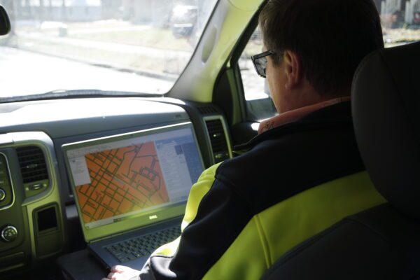
The first step in improving a community’s infrastructure is understanding what roadway data has been collected already. Whether you have detailed records or none at all, rest assured that no city or town has the resources to collect every piece of data for a pavement network.
That’s where we step in.
With more than 20,000 centerline miles of municipal roads rated in the Southeast alone, we work with clients to choose a methodology that will yield accurate data to make sound maintenance decisions and maximize available funding.
“Just like in anything, having current data allows us to make better decisions,” states WithersRavenel Pavement Manager Rob Holland. “It helps us understand the current condition of the roadway so that we can then make recommendations for treatment, preservations, or repairs. If we don’t have up-to-date information, then the community’s decisions and ours will not be reflected accurately.”
The collection of data is performed through a pavement condition survey (PCS). WithersRavenel’s Pavement Management team uses the following industry-standard rating methodologies to conduct a PCS:
- ITRE
- Long-Term Pavement Performance (LTPP)
- PASER
- ASTM D5340
- ASTM D6433
Each system offers distinct advantages, and WithersRavenel will work with clients to identify which rating system will best serve their needs and improve their community.
When is the right time to conduct a PCS?
Like a routine visit to the doctor’s office for a physical, it’s important to keep a close eye on your roads. The Federal Highway Administration recommends conducting a PCS every two to three years. Much like delaying that trip to the doctor, things can drastically change over time, and omitting routine surveys can make it much more challenging to make sound decisions that will improve or sustain current road performance.
We recommend re-evaluating existing data each year to:
- Note any known changes to the roadway network,
- Integrate new utility projects,
- Plan around proposed new construction projects, and
- Consider resident comments and concerns.
Finding the right time to conduct a PCS is dependent on a community’s geography, weather, and funding availability. So long as your roadways aren’t buried beneath layers of snow, a PCS can happen at almost any time of the year.

“A lot of things are taken into consideration before we do a PCS,” says Holland. “Road construction usually takes place between March and November. We try our best to work around those schedules. Fiscal years vary from state to state; thus, some municipalities wait to assess how much funding is available before conducting a survey. In short, we can start almost anywhere at any time given the conditions are ripe.”
Transforming data into actionable insight
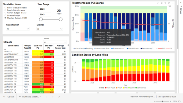
Now that you’ve got data from the PCS, let’s turn that information into practical plans to improve your community’s road network. WithersRavenel takes the collected PCS data and turns it into a lifecycle model that depicts 20+ year asset lifespans and accounts for multiple model impact scenarios such as budget variations and pavement treatment options. Through these models, decision-makers can see where their infrastructure is most vulnerable. We then work with communities to develop a roadmap that seeks to stop failures before they ever occur.
“An elected official recently told me that they have a greater level of confidence in predicting how a decision they’re making today is going to impact the future of their community,” notes WithersRavenel’s Product Manager Becca Ruffin. “They’re thinking about the long-term impact and viability of their infrastructure, decades into the future—and one of the ways that you can do that is by tracking pavement conditions of road networks.”

Lifecycle modeling and planning can be likened to a crystal ball for the effective management of pavement infrastructure. By starting from the current condition and expected lifespan of pavements and factoring in budget considerations, decision-makers and leaders can forecast road conditions for decades to come.
Through this process, community leaders can engage in numerous what-if situations: what could we accomplish if we had more funding? what happens if we defer repairs? By having this information available communities can strategize and execute decisions that safeguard the long-term sustainability of roadways.
Ready to get started?
Whether you’ve got a treasure trove of detailed records or are just starting to build your pavement data inventory, understanding your roadways is essential in building a pavement management program that works effectively. If you’re ready to get started on this journey with a PCS, don’t hesitate to contact WithersRavenel’s Director of Pavement Management Steve Lander, PE at slander@withersravenel.com.
If you already have data and are ready to get it implemented into a lifecycle model, connect with WithersRavenel’s Product Manager Becca Ruffin at rruffin@withersravenel.com.
At the end of the day, it’s all about keeping your community rolling smoothly and making roads safer, sustainable, and within budget. After all, there’s more to pavement management than just pavement.
In This Series:
- Resilient Communities: How to Plan, Prepare, Respond, and Recover
- All together now: How asset management, stormwater, and planning can help build community resiliency
- Climate hazard adaptation and mitigation planning: The first steps toward building resiliency for NC communities
- WithersRavenel’s drone pilots bring data and details to climate resiliency planning
- Asset inventory, management can play key role when seeking funding assistance following a disaster
- Stormwater system management and funding are integral to changing weather conditions
- The FEMA BRIC program is a valuable funding source for resiliency projects
