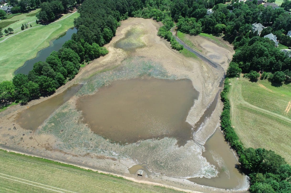
As part of a wider project for Wake County, WithersRavenel and partner firm Schnabel Engineering undertook a pilot sedimentation study of the Coles Branch Dam and watershed located in Morrisville and Cary. Coles Branch Dam is the smallest and shallowest of the Wake County dam sites, which made it an ideal candidate for the study.
Why study sedimentation?
In the 1970s and ’80s, Wake County constructed ten dams to mitigate flooding from Crabtree Creek. These flood control dams were constructed with federal funding and technical assistance of the U.S. Department of Agriculture’s Natural Resources Conservation Service (formerly SCS). In addition to providing flood control, several of the dams became amenities for well know local parks – Shelly Lake, Lake Lynn, Lake Crabtree, and Bond Lake. As the dams approach 50 years of age, the County is assessing their condition and ability to meet their 100-year design life. The evaluation is critical, as flood control is a vital safeguard of lives and property.
During rain events, sediments from erosion of streams, construction, and general development are brought into the dam reservoirs. Once sediment builds up above the normal water level, the dam’s ability to provide flood control is reduced.
The pilot study evaluated sedimentation at Coles Branch Dam reservoir using several newer and older technologies and then compared results with previous studies. The study assessed the loss of surface area and flood storage capacity, and then took a detailed look at the sediments, both above and underwater. This was a big difference from prior sediment studies when above-water/aerated sediments were not measured.
New remote sensing technologies
The pilot study used three remote sensing methodologies to map the bathymetry (the terrain of riverbeds, pond bottoms, or the ocean floor) and measure sediment thickness: ground penetrating radar (GPR), echosounder (sonar), and light detection and ranging (LiDAR). In addition to the remote sensing methods used, the older physical range pole methodology was applied to the survey area to measure the bathymetry and sediment thickness. Dam structures were also surveyed with conventional and LiDAR technologies to update information for future structural studies. Importantly, the pilot study compared the pros and cons of the methods, while also analyzing the results and their accuracy to make recommendations for survey methodologies for the remaining dams.
The results at the Coles Branch Dam show that the rate of sedimentation is likely to completely fill the reservoir pool over the next 29 years, falling short of the 100-year design life. The team in this study looked at several options to address sedimentation of the dam and the cost to the County for each option. Recommendations were made for methods to dispose of excess sediment, keeping in mind transportation, environmental permitting, and the possible obstacles in removing the sediment deposits from the reservoir.
Removing sediment
To meet its design goal, our design team proposed the removal of approximately 13 acre-feet of sediment (which translates to enough sediment to cover 13 acres of land at a depth of one foot) to preserve the flood storage capacity of the reservoir for the remainder of its design life.
This project provided our design team an opportunity to apply technologies to field data collection scenarios where they would normally not be feasible. For instance, performing multiple data collection methods over the same survey area provided massive amounts of data points to compare. As a result of those comparisons, conclusions could be drawn about the best method of measuring the water depth and sediment depth for the remainder of Wake County’s dams. Efficient measurement of sedimentation as well as evaluation of the dam structures will help Wake County prioritize work on the dams to maintain their flood control function.
Learn more about how our dam services engineers and experts can help you by contacting Senior Technical Consultant Sam Ravenel at sravenel@withersravenel.com.
