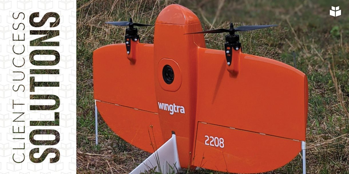
WithersRavenel loves technology, and the WingtraOne drone is the newest addition to our stable of remote sensing tools.
What is it?
 WingtraOne is a fixed-wing, vertical takeoff and landing (VTOL) drone. That means that it looks and flies like an airplane, but it takes off and lands like a helicopter. It has a flight time of about 45-50 minutes, the longest of our drones.
Like other drones, the WingtraOne can carry different types of data collection sensors, including traditional photo sensors and infrared/thermal, hyperspectral, and multispectral imaging sensors.
How does it work?
VTOL allows for safer takeoffs and landings for both aircraft and operators. Single-rotor and multi-rotor drones ones that look like helicopters typically require less area for their launch and recovery zones. Traditional fixed-wing drones rely on catapult systems or human operators to launch them into flight, and their landings are closer to a controlled belly crash than a graceful touchdown. The WingtraOne, on the other hand, does not require human intervention to takeoff, and it returns to the ground on specially designed landing gear.
The WingtraOne’s flights are programmed and autonomous. Flight planning software allows the pilot to design a flight plan per project parameters and upload to the drone for execution. A ground station tablet tracks real-time telemetry information from the drone in flight, including wind speed, flight speed, altitude, battery life, and progress through the programmed flight.
Why we’re excited
We have equipped our WingtraOne with a 42-megapixel camera. The combination of high-resolution photo sensor with the drone’s longer flight time means it can not only fly farther but also much higher while still achieving map-grade resolutions. It can effectively cover a small, 10-acre site in 5 minutes and a 1,000-acre site in just a few hours.
The WingtraOne also allows us to provide orthophotography at a lower cost on projects where using other tools would be cost-prohibitive. We can create imagery of a project site much more efficiently at more frequent project milestones imagery that would never have been considered with other tools.
Finally, the WingtraOne provides a greater level of quality control than other drones using Post-Processed Kinematic (PPK) technology. PPK is a GPS correctional technology that works to correct the location data the drone collects while flying. By comparing the drone’s positional data to base station GPS receivers, the accuracy of the data can be improved by as much as 75 percent.
A major benefit of PPK is reliability. Because drones with PPK do not depend on real-time data to stay on their flight path, temporary losses of connection do not disrupt their flights.
Which projects are good candidates for WingtraOne?
There are three kinds of projects where we have seen the most success using the WingtraOne: corridor mapping, grading surface comparisons, and large land tracts.
Corridor mapping
The WingtraOne is particularly well-suited to projects with a long and narrow profile such as water or sewer mains or highway corridors. Its longer flight times and higher altitudes mean less in-air time for the drone and less field time for the flight crew, resulting in a more efficient project with a high-quality deliverable.
Grading surface comparisons
At the outset of a project, we fly the site using a drone equipped with LiDAR. Then we follow up throughout the project by conducting multiple incremental flights with the WingtraOne to capture ground surface photogrammetry. Finally, we run surface comparisons to check the volume of material that has been moved and the volume that remains to be moved to achieve the desired design grade. Operating the smaller WingtraOne for the follow-up flights allows for less flight time and quicker data deliveries, saving our clients time and money.
Large land tracts
Land development requires surveying large tracts of land still in its raw form. Boundary and ALTA surveys still require traditional boots-on-the-ground methods, but with WingtraOne, we can create aerial imagery to support the ALTA survey. By layering the final ALTA map over the up-to-date aerial imagery, the project surveyor can map features from the accurate orthophoto and make sure no improvements were excluded in the survey. This step provides an additional level of quality control.
If you have a project that falls into one of these three categories, or you want to discuss whether the WingtraOne might be the right choice for a less-conventional undertaking, reaching out to Karen Shank at (919) 238-0381 or kshank@withersravenel.com or Seth Swaim at (919) 535-5128 or sswaim@withersravenel.com.
