Jockey’s Ridge State Park is a premier destination on the Outer Banks. In fact, it is the most visited state park in all of North Carolina, hosting nearly 1.9 million visitors in 2020. The park boasts more than 400 acres of living, active dune; maritime forests; and nearly a mile of estuarine shoreline. This shoreline is a mix of sandy beach and fringing coastal marsh. Since the park was established, erosion along the shoreline has been a concern. This erosion is attributed partially to development pressures from the 1970s that were never mitigated for, partially to the living-active dune system that can blow sand onto the fringing coastal marsh, and partially to the erosional forces of the Roanoke Sound and recreational activities.
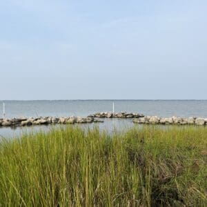
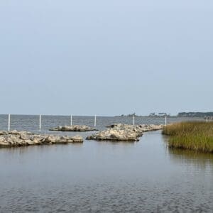
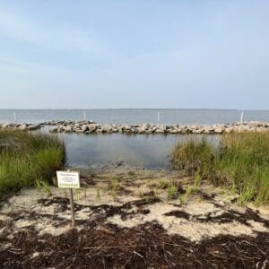
A high-priority area of the Jockey’s Ridge shoreline was selected for restoration work that included offshore rock sills and native plantings. Quible & Associates, P.C., (now WithersRavenel) was engaged by the North Carolina Coastal Federation (NCCF) to provide project design, permitting, surveying, and management. The Phase I rock enhancement was completed in 2024. The project was funded by a variety of public and private grants. To date, seven grants have been secured to contribute to the restoration project, including the Dare Tourism Impact Grant, Fish America Foundation and several private foundation grants.
Marsh grass plants have been installed with the use of volunteers during the spring and summer of 2023 and 2024. Species used include: Spartina patens, Juncus roemarianus, Spartina alterniflora as well as some native bulrush and other native wetland vegetation.
The restored marsh will enhance and promote submerged aquatic vegetation (SAV) by creating a protected shallow water zone of sufficient depth and bottom type to attract various species of SAV.
Quible was re-engaged to perform an as-built survey of the Phase I Sill System and a complete shoreline, SAV and bathymetric survey of the Jockey’s Ridge Property. The success of the Phase I enhancement work prompted the Park and NCCF to pursue a living shoreline expansion that will be referred to as Phase II (permit under review as of January 2025). The expansion location is from the north end of the existing sill system to the north park property line. This includes approximately 888 LF of new rock installation (400 LF main sills, 90 LF overlap protection and 398 LF of marsh toe revetment). This northern park area is the preferred living shoreline expansion location and installation work is expected in 2025 or 2026.