Wilson County land-use plan
WithersRavenel’s Community Planning team crafted a comprehensive land-use plan for Wilson County, defining a clear vision for the future while outlining policies and strategies to support planning efforts and local priorities. This plan serves as a roadmap for guiding Wilson County’s growth and development for now and in the years ahead.
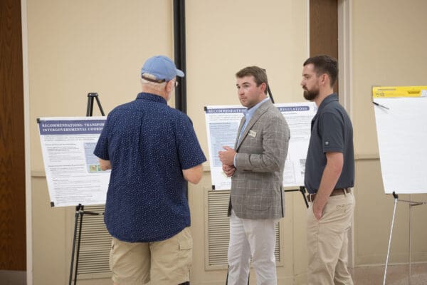
Beginning with background research and analysis, our planners sought to understand existing conditions in the County and evaluate projected trends. Input from a key stakeholder group in the County, which included government department heads, administrative leadership and citizens, was vital to initial understanding. We followed this up with open public engagement to give people the opportunity to share opinions and offer specific input.
After public input and survey results were tallied, visioning and goal setting proceeded with the key stakeholders to craft a set of guides for the land-use plan and future land-use map. The products reflect specific local desires identified during the process and were reviewed by stakeholders and the public. Ultimately, the plan provides developers, citizens, and elected officials with a guide to assess development and infrastructure proposals, while also identifying projects or tasks to include in County Capital Improvement Plans (CIPs).
What were goals of the Wilson County land-use plan?
The following community goals were among those identified:
- Collaboration with other entities to boost a variety of housing types, while guiding residential growth toward cities and towns
- Facilitating regional economic development and the development of high-paying jobs
- Prioritizing transportation planning to serve residents and businesses
- Preserving rural and agricultural areas, along with natural resources, while promoting agritourism and farm production
- Strengthening partnerships with towns and cities
The success of a comprehensive plan depends on its effective implementation. To support this, the WithersRavenel team developed a plan recommendation matrix, providing clear, actionable steps to achieve the plan’s overarching goals, along with a metric to track progress on each recommendation.
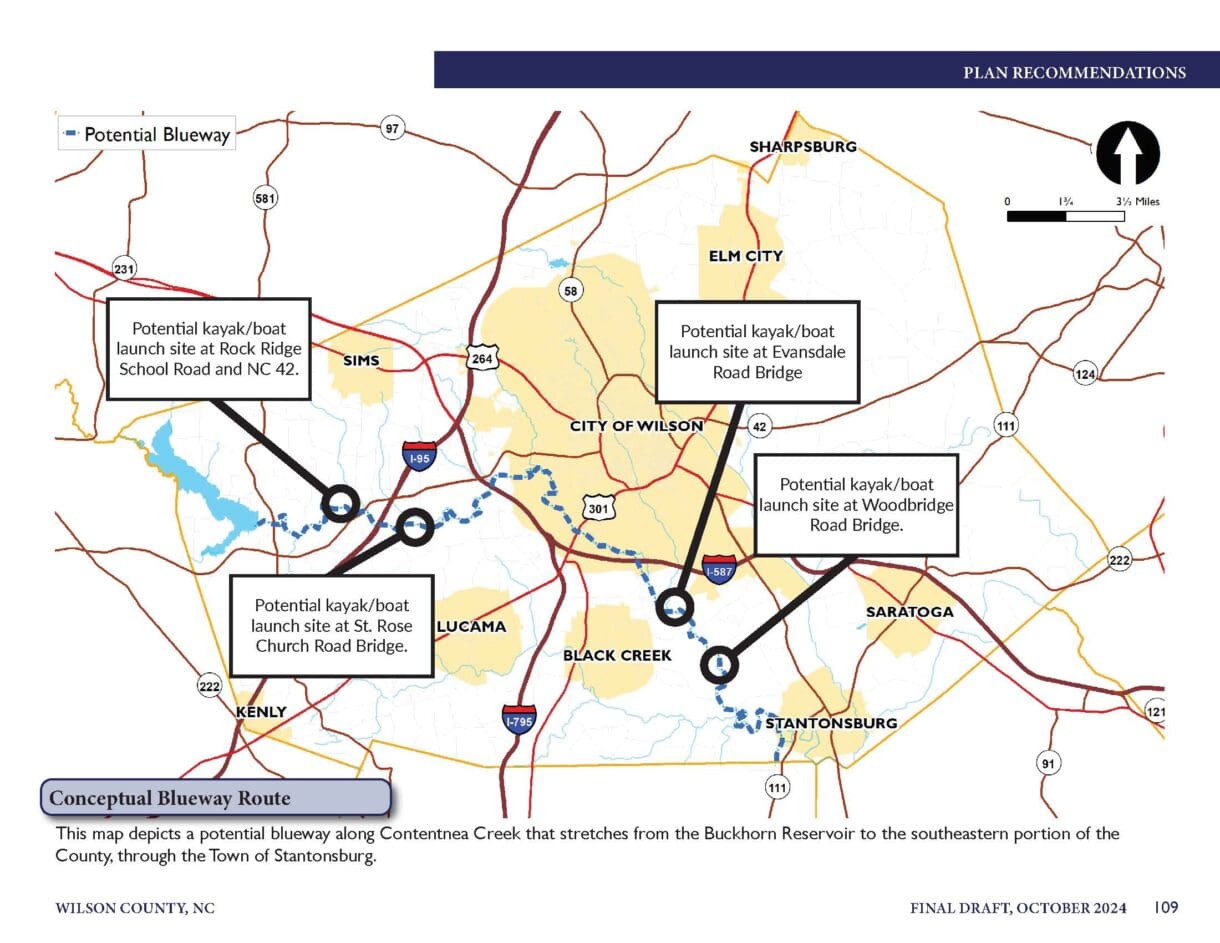
In addition to policy recommendations aimed at enhancing residential community design, promoting diverse housing options in new developments, and improving roadway interconnectivity, the plan also introduced specialized initiatives. These included the exploration of a blueway network along a major waterway in the County and the creation of a County-specific branding designation to support and promote local farming operations.
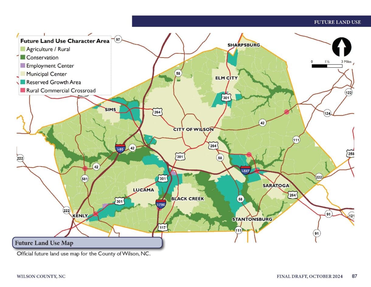
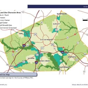
A key part of the plan is the Future Land Use Map. This map helps staff, elected officials, and the community, serving as a guide for reviewing development proposals to see if they match the County’s long-term vision.
As part of this effort, six Character Areas (Future Land Use Designations) were established, each with distinct characteristics, including:
- Referred and discouraged land uses
- Transportation considerations
- Utility planning
- General development design guidelines
County commissioners unanimously approved the plan, solidifying its role as a strategic framework for guiding the County’s future growth and development.