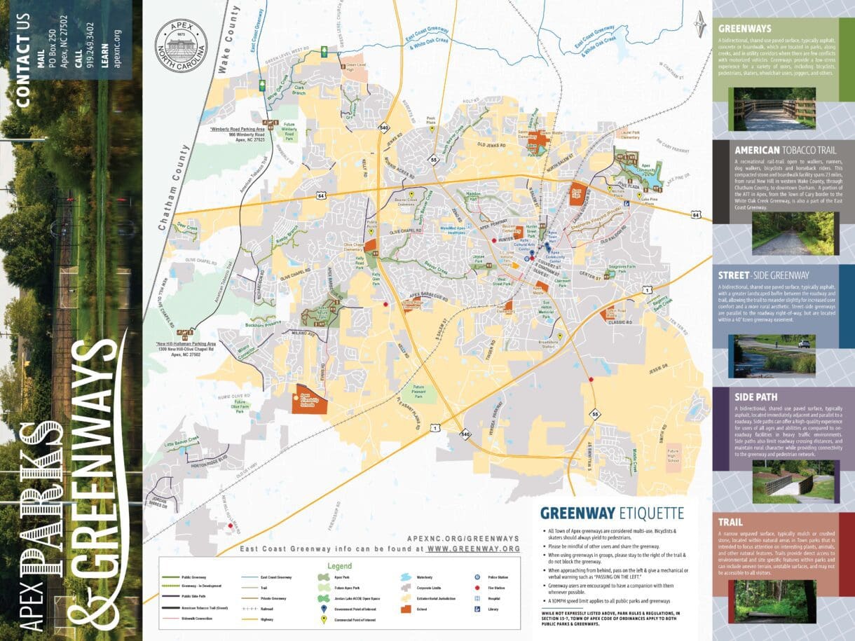
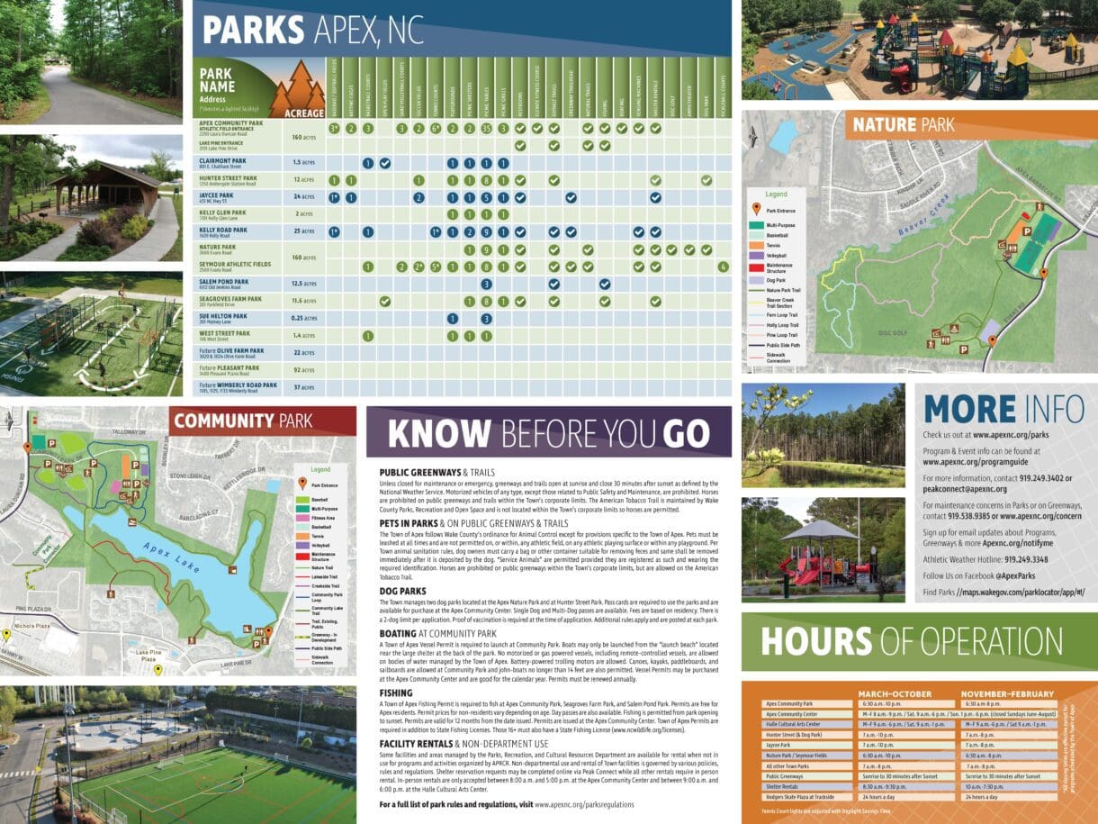
The Town of Apex maintains more than 11 miles of greenways and trails, and it wanted a way to convey helpful information to citizens about this public amenity. Using the Town’s GIS data, WithersRavenel created a map of the greenway system. The map not only showed trail routes and entry/exit points, but also included other points of interest like parks, libraries, and schools.
Utilizing the GIS data, WithersRavenel’s branding and GIS teams joined together to produce a brochure with the map and enhanced it with photos, hours of operation, a facility finder, and reminders about park rules and regulations. This layout was designed to scale for printing at both handout and poster size.