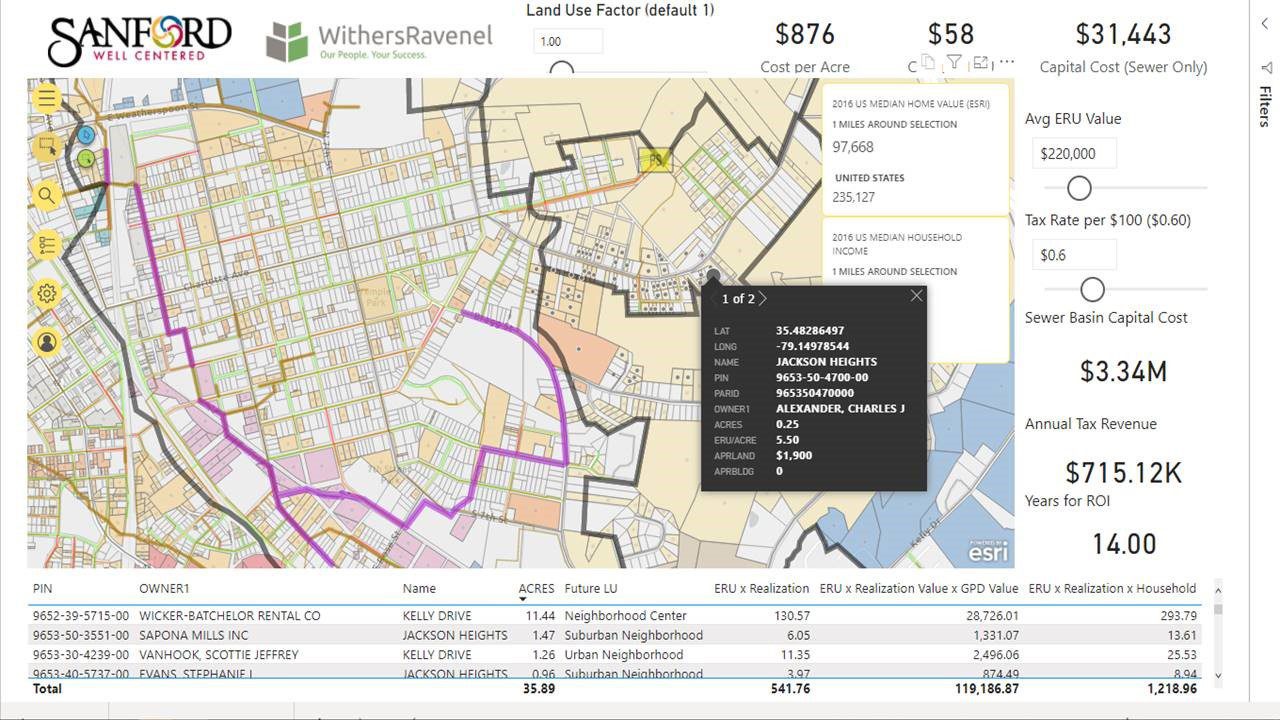
Traditional site selection methods are time consuming and involve sifting through real estate listings, visiting possible sites, and performing complex, spreadsheet-based calculations. WithersRavenel, with the help of Dude Solutions’ Capital Predictor¢ software, can cut through the noise to find the right fit quickly using predictive land use modeling.
How It Works
Capital Predictor is a cloud-based asset management tool that provides robust data visualization, mapping, and what-if scenario modeling. WithersRavenel is partnering with local governments to transform their static land use plans into dynamic land use models with Capital Predictor.
Each model, at a minimum, includes a map of the municipality’s or county’s jurisdiction with each parcel coded according to its approved land use(s). WithersRavenel can then import GIS data from the relevant real estate database to assign property values and tax bill amounts. We can also create additional layers for the locations of major sewer basins, water and wastewater treatment facilities, pump stations, and water and sewer mains, if available.

Why It Helps Developers
Quickly compare property and development costs. Hovering over a specific property reveals details like lot size and development costs. Importantly, those costs include both cost per acre and ERU (Equivalent Residential Unit) of all sewer capital costs. This enables an apples-to-apples comparison and allows developers to avoid properties that require additional infrastructure investment if that is not desirable on their intended project.
Identify opportunities to combine or subdivide parcels. The map is automatically filtered to show developable properties, and it can be further filtered by intended land use. If the available parcels do not satisfy a project’s needs, the user can click and drag to see, at a glance, the associated costs to develop multiple properties.
See the proximity of infrastructure and other land uses. In addition to major highways and local roads, the model can incorporate greenway networks, park locations, and schools. This makes it easier for developers to situate retail locations near areas of high foot traffic or housing near existing community amenities.
What’s Next?
If you are considering a residential, commercial, or mixed-use development project, reach out to the relevant jurisdiction and ask if they have an interactive land use model. If not, contact Eddie Staley at (919) 535-5207 or estaley@withersravenel.com to find out how WithersRavenel can work with you and local government staff to facilitate the land use modeling process.
