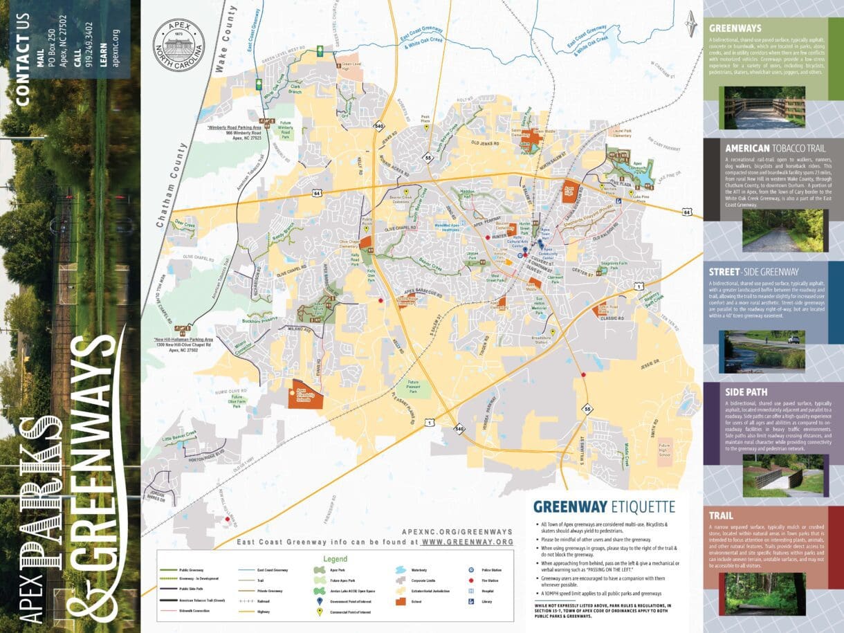
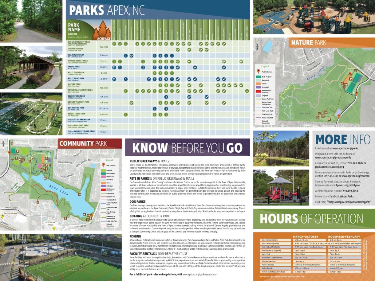
The Town of Apex maintains more than 11 miles of greenways and trails. It wanted a way to convey helpful information to citizens about this public amenity. Using the Town’s GIS data, WithersRavenel created a detailed map highlighting the entire greenway network—often referred to as the Apex Greenway Map. As a result, community members could easily find their way. The map not only showed trail routes and entry/exit points, but also included other points of interest like parks, libraries, and schools.
Utilizing the GIS data, WithersRavenel’s branding and GIS teams joined together to produce a brochure with the greenway map. They enhanced it with photos, hours of operation, a facility finder, and reminders about park rules and regulations. For reference, all this valuable information is featured as part of the official Apex Greenway Map resource. This layout was designed to scale for printing at both handout and poster size.