WithersRavenel’s drone team dispatches to help NCDOT with aerial damage assessment
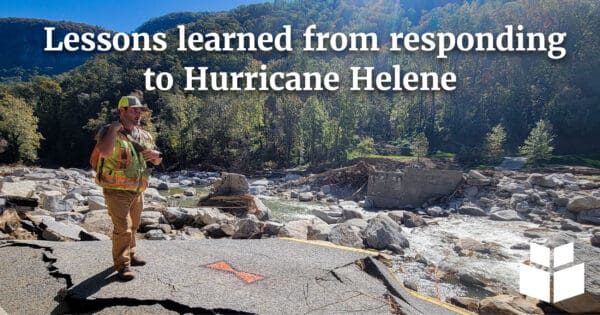
In the aftermath of Hurricane Helene, WithersRavenel worked with NCDOT. They assessed major damage from flooding and landslides in Chimney Rock and Bat Cave. Following the storm, our Remote Sensing crews deployed fast to start the survey process. The work followed an expedited timeline to support emergency roadway design. Survey control networks were quickly established in collaboration with other consultants to ensure alignment in NCDOT deliverables. We also provided additional conventional control and property surveys for the NC-9 corridor for the design engineer to complete that project.
Rapid mapping via survey technology
Our Unmanned Aircraft System (UAS, or drone) team quickly mapped planimetrics and topography. The team provided more than 4 miles of data within the affected areas using drone-based orthomosaic imagery and LiDAR. Wingtra technology was used for imagery, while LIDAR data was obtained with a Riegl sensor.
Specific corridors our pilots mapped were NC-9 from Bat Cave north to the Buncombe County line.They also mapped US-64, also known as US-74 ALT, from Bat Cave east to Chimney Rock.
Challenges from damaged areas
Challenges were numerous, including more than one mile of roadway that was nonexistent due to the extensive flooding. Survey control and flight takeoff locations were also difficult to access in that portion of the project area.
Key data aids in rebuilding damaged roads
The key data helped road design and rebuilding start in earnest in some of the region’s most damaged areas. Additional LiDAR surveys were completed in the same areas. They focused on the new alignments of three streams. The streams were Grassy Creek, Hickory Creek, and Reedy Patch Creek. The surveys also covered the Broad River. These additional topographic datasets will assist NCDOT in studying the erosion and hydrology impacts from Hurricane Helene.