Imagine trying to build a bridge without understanding the land’s contours. Or being aware of the surrounding utilities and synthetic features. What about planning a new road without knowing how the terrain slopes. Or even constructing a high-rise without verifying property boundaries.
Without surveying services, these tasks would be next to impossible.
Surveying provides engineers with precise data. This data is used to design safe, efficient, and lasting infrastructure, buildings, and roadways. It directly impacts communities by ensuring that homes, schools, and public spaces are built where they should be. They are built with the intent of the Engineers. Additionally, roads are constructed with resiliency emphasized. Without accurate surveying, infrastructure failures could disrupt daily life. They can increase costs and pose safety risks to residents. The #1 charge of Land Surveyors is to protect the public.
It forms the foundation of development projects and affects our daily lives. But why does surveying matter for communities? It ensures that every project, from roads to utilities, is built with precision, safety, and sustainability in mind. This ultimately shapes the spaces where we live, work, and connect.
The Benefits of Surveying Services for Communities
Accurate Planning & Design
Surveying delivers precise measurements of land contours, boundaries, and topography. This enables engineers and planners to design projects that are safe, efficient, and cost-effective. Using industry-standard electronic and robotic-assisted equipment, surveyors ensure the accuracy of engineering, design, and permitting documents.
When specific conditions are met, advanced tools like unmanned aircraft systems (UAS) can add value. LiDAR technology provides high-resolution imagery and a greater volume of data points. This enhances planning and decision-making.
Regulatory Compliance & Risk Reduction
Proper surveying ensures that projects adhere to zoning laws, property boundaries, and environmental regulations. This reduces legal disputes and costly errors. The boundary survey process begins with researching historical records, both digital and paper. This identifies potential encroachments, gaps, and overlaps between properties.
Field crews then conduct surveys to accurately map easements, rights-of-way, natural features, and property improvements. This information is crucial for projects such as land subdivision. Surveyors assist Engineers by supplying all relevant and current conditions pertaining to the land in order to aid in the creation of certified construction plans for new neighborhoods.
Improved Construction Efficiency
Accurate survey data helps construction teams anticipate site conditions, minimize material waste, and streamline project timelines. Unforeseen site challenges, such as unexpected underground utilities or changing material availability, often necessitate design adjustments in the field. Properly recorded survey data ensures these changes are documented, making future maintenance and infrastructure development more efficient.
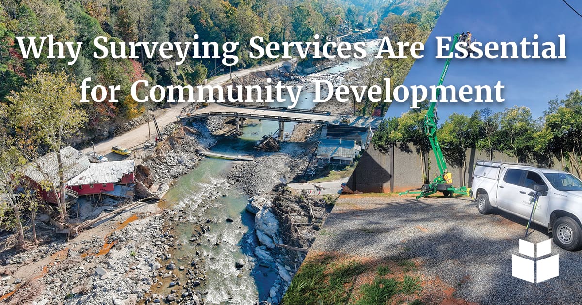
Real-World Impact: Surveying in Disaster Recovery
Natural disasters underscore the critical role surveying plays in rebuilding communities. The importance of accurate data and precise mapping becomes even more evident. This is crucial when infrastructure is compromised, requiring swift and reliable solutions.
The importance of surveying was evident in the aftermath of Hurricane Helene. This was observed when WithersRavenel partnered with NCDOT to assess flood and landslide damage in Western North Carolina. Working on an expedited timeline, Remote Sensing teams were rapidly deployed. They surveyed the affected areas and laid the groundwork for emergency roadway design.
Survey control networks were established in collaboration with other consultants. This ensured consistency in NCDOT deliverables. Conventional control and property surveys were conducted along the NC-9 corridor. Our UAS teams used drone-based orthomosaic imagery and LiDAR to map over four miles of affected terrain.
Portfolio: NCDOT Hurricane Helene UAS Response
Challenges were numerous as some roadways had been completely washed away. Access to critical survey points was limited. To overcome these obstacles, surveyors used all-terrain vehicles and drones. They reached inaccessible areas while deploying remote sensing technology to collect data efficiently. Collaborative efforts between field teams and engineers were crucial. This allowed for rapid analysis and adjustment of survey methods, ensuring accurate mapping despite difficult conditions.
Despite these obstacles, the crucial data collected enabled road design and reconstruction to begin swiftly in the hardest-hit areas. Additional LiDAR surveys helped study erosion and hydrology impacts on key water bodies.
Why Surveying Matters
From daily infrastructure projects to emergency disaster recovery, surveying ensures communities remain safe, functional, and prepared for the future. Without it, development would be unreliable, costly, and inefficient. Investing in high-quality surveying services is not just a technical necessity. Surveying is a commitment to building resilient and thriving communities.
Let's Connect!