Written By:

WithersRavenel Stormwater Engineer Alisha Goldstein recently joined experts from the public and private sectors at the 2026 National Oceanic and Atmospheric Administration Industry Partnerships Summit in Silver Spring, MD.
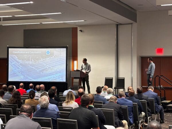
Alisha participated in the September 1 panel, “Cross-Sector Conversation on Complex Flooding: Understanding Risk Before and After Helene.” The discussion examined how environmental data shapes decisions, how Hurricane Helene changed the understanding of complex flood risk, and how organizations can apply those lessons to strengthen resilience.
Hosted by NOAA’s National Centers for Environmental Information, the three-day summit brought together leaders from the insurance and reinsurance, architecture and engineering, and retail and supply chain sectors. The event created an opportunity to connect NOAA’s research and environmental data with the real-world decisions that affect infrastructure, services, and communities.
Trusted Data Requires Clear Communication
A consistent theme throughout the summit was the industry’s reliance on NOAA for reliable and transparent environmental data. Engineers, planners, and other professionals use that information to understand hazards, evaluate risk, and inform infrastructure decisions.
But access to data is only part of the equation. Technical professionals must also explain what the information means, where uncertainty exists, and how it can guide action.
For state and local government leaders, clear communication can connect technical findings with decisions about infrastructure priorities, emergency preparedness, capital investments, and community needs. Data creates greater value when decision-makers and the public can understand how it relates to the choices in front of them.
This connection between sound information and clear communication is central to WithersRavenel’s work with communities. Technical analysis must ultimately help leaders determine what to address, when to act, and how to explain those decisions to the people they serve.
Planning for Infrastructure That Can Safely Fail
The conversation also reflected a growing recognition that infrastructure planning must account for disruptions that cannot always be prevented.
A safe-to-fail approach acknowledges that the magnitude of severe weather and other hazards may exceed a system’s intended capacity. Rather than assuming every disruption can be avoided, communities can plan for how systems will respond, limit consequences, protect critical functions, and recover.
This approach requires leaders to consider both parts of risk: the probability that a failure will occur and the consequences if it does. A lower-probability event may still require attention when the potential effects on public safety, essential services, property, or community recovery are significant.
For communities, this broader view of risk can lead to more useful planning questions:
- Which assets or services would create the most significant consequences if disrupted?
- What functions must remain available during and after an event?
- Where could one failure create additional problems elsewhere in the system?
- What operational, financial, and communication plans would support recovery?
- Which investments could reduce risk or make recovery more manageable?
These are not questions that communities answer through infrastructure design alone. They require coordination among engineering, planning, public works, emergency management, finance, communications, and community partners.
Resilience Includes People and Systems
The session also explored the relationship between physical and social infrastructure. Roads, utilities, drainage systems, buildings, and other assets are only part of a community’s ability to withstand and recover from disruption.
Social infrastructure includes the relationships, communication channels, procedures, and community networks that help people share information, coordinate resources, and respond to changing conditions.
Considering physical and social systems together gives communities a more complete view of resilience. Even well-designed infrastructure may not perform as intended if responsibilities are unclear, information does not reach the people who need it, or recovery plans do not account for residents who face greater barriers before and after a disaster.
This broader perspective is especially important when evaluating complex flooding. Rainfall, drainage systems, waterways, transportation routes, utilities, land use, and community resources can all influence how an event affects a particular area. Understanding those connections can help communities prepare for both the physical impacts and the demands placed on staff, residents, and response organizations.
NOAA Tools for Informed Planning
The summit gave attendees an opportunity to explore several NOAA tools that can support engineering, risk assessment, and infrastructure planning:
- Typical Meteorological Year provides current and projected typical weather data for specific locations. Engineers can use the information to evaluate energy demand and inform the design of efficient heating, ventilation, air conditioning, and water systems.
- Climate Atlas provides customizable temperature and precipitation maps that can help users visualize historical patterns and emerging trends.
- Storm Events Database allows users to research more than 55 types of weather events and review information about storm paths, impacts, costs, losses, and other event details.
- ADT-HURSAT provides consistent tropical cyclone intensity estimates that can support long-term analysis, risk assessment, and hurricane preparedness.
- Event Footprint Catalog uses interactive maps to illustrate the location, type, intensity, and physical impacts of extreme weather events.
NOAA also previewed the U.S. Precipitation Time Series Explorer, which will provide historical and near-real-time hourly precipitation data for locations across the United States. NOAA indicated that the tool is scheduled for public release in fall 2026.
Connecting National Data to Community Decisions
The ideas discussed at the summit connect directly to the work WithersRavenel supports with state and local governments. Building resilience requires more than applying environmental data to a model or design. It requires understanding how hazards could affect interconnected systems, where the consequences are greatest, and which planning, operational, or infrastructure decisions can reduce risk before an event occurs.
Alisha’s role in the discussion connected NOAA’s national datasets and research with the decisions communities face locally. Her stormwater engineering experience brought a practitioner’s perspective to questions about how data is interpreted, communicated, and applied to infrastructure planning.
That exchange works both ways. Public agencies and data providers benefit from understanding what engineers and communities need to make informed decisions. Practitioners, in turn, depend on reliable information to help communities evaluate risk, communicate complex conditions, and identify practical paths forward.
Through this work, WithersRavenel helps communities move from information to action. That can mean evaluating infrastructure vulnerabilities, considering the consequences of disruption, coordinating across departments, and identifying investments that support long-term preparedness and recovery.
The summit reinforced that resilience is not a single project or dataset. It is an ongoing process of using trusted information, technical experience, and community knowledge to make better decisions before the next disruption occurs.